


Ariadna IC2G
Ultraportable live network LV cable identifier

There are many situations in which it is necessary to quickly and accurately identify live Low Voltage (LV) cables, for example, when opening a trench, making a branch in a line, before carrying out some maintenance tasks, when making a new connection, …
Merytronic has developed the Ariadna IC2G, an ultra-portable Cable identifier device that is used for positive cable identification, in Low Voltage cables.
The device consists of a transmitter (IC2G-TX) and a receiver (IC2G-RX). Its use is simple: the transmitter (TX) is connected to an LV cable and the receiver (RX) is used to identify or locate that cable upstream, towards the MV/LV transformer.
- Positive cable identification without de-energising the network
- Works on LOW VOLTAGE distribution cables up to 250 V (50-60 Hz)
- Sensor Rogowski: identifies cables by placing the sensor around the cable
- U” sensor: identifies conductors by touching the cable
- Single-phase and three-phase cables
- Fast identification, achieved in seconds
- Simple operation due to automatic synchronisation between transmitter and receiver
ILF G2 | ILF G2Pro
LV Network Topology

The new generation of identifiers, ILF G2 | ILF G2 Pro, has been designed to add, edit and store over the same map (thanks to the GridGIS Connect app developed by ARIADNA Grid) the location and connection of all consumers in the Low Voltage distribution network, that is to say, it allows identifying and digitalizing which Transformer Substation, LV panel, outgoing feeder and phase each of the meters (subscribers) are connected to.
This new generation of equipment is aimed to big mapping campaigns of distribution networks, helping to reduce the campaign’s duration and leading to great cost savings.
Main features
- Identification of the 3 phases and up to 12 feeders/outgoings of a LV panel (several devices can be placed in parallel if there are more outgoings).
- LV Live Network topology identifier (without de-energizing).
- Designed for big network mapping campaigns, up to 99 teams can work at once.
- Suitable for different distribution network arrangements, in cascade mode or / and in parallel (allowing to know the connectivity of the consumer with respect to each distribution element of the LV network).
- Integrated Bluetooth connection for automatic data transfer to GridGIS Connect mapping app (compatible with any GIS systems). License included with the device.
GridGIS

GridGis Connect
In order to manage efficiently the distribution network it is essential to have a precise and up-to-date knowledge of the topology data of the Low Voltage grid.
GridGIS Connect app enables field personnel to work with the ILF G2 | ILF G2 Pro, phase and feeder identifiers, and store automatically identification results of electric meter electric connection upstream with Secondary Substation (SS), feeder and phase (electric meter topology).
Suitable for different distribution network arrangements, wether in parallel or cascade mode on wich user can determine the topology data of the consumer with respect to all its distribution elements upstream (Feeder Pillars, or similar) of the LV network, in one only measurement.
Through this application captured data is displayed, on a map view of the work area. After completing work, the results are exportable to the Utility GIS system in a quick and easy way.
 GridGIS Map Creator
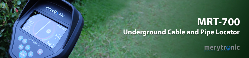
GridGIS Map Creator app allows to map, with GPS coordinates, aerial/underground MV and LV electrical networks with different assets directly on the field. Design to work with the MRT-700, underground cable locator de Merytronic.
Page 2 of 3
 |
2025 Electrical Testing Expert Catalog

Megger Transformer Catalogue
![]()
Megger Cable Catalogue

Industrial Maintenance Solution

Megger Power Catalog

Merytronic
Portable Devices

Fluke 2025 - 2026 Product Guide

Solucao Product Catalog

Orion Electrical Safety Rubber Equipments Catalogs

BETE Electrical Construction Tools 2025

MULTI Main Sales Product Line 2026

ANHU Electric Catalog
